


Who doesn’t know what a geyser is? These powerful jets of hot water and steam draw many to them. However, did you know that they’re actually quite rare? There are only a handful of places on the planet one can go to view a geyser. An even smaller number of locations host large predictable eruptions. So consider yourself fortunate if you’ve seen one in person!
.
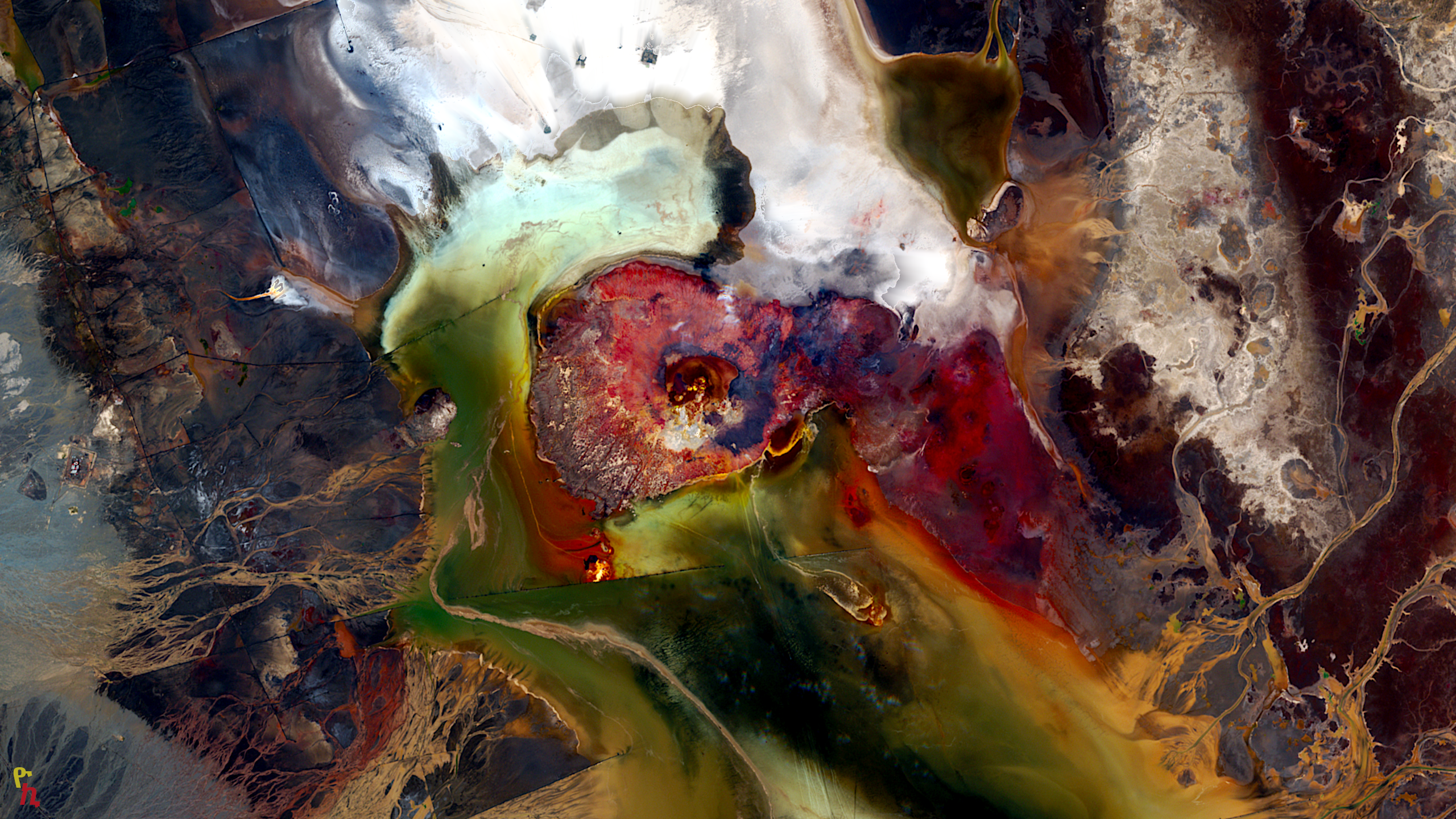
9. Dallol Region, Danakil Depression, Ethiopia
The Danakil Depression, located in northeastern Ethiopia near the border with Eritrea, is one of the hottest and lowest places on Earth. The reason being the African continent is rifting apart here, generating a lot of heat from Earth’s interior. This area is characterized by its extreme geothermal activity, resulting in an otherworldly landscape of hot springs, geysers, and vibrant mineral deposits.
The geysers of Ethiopia, particularly those found in the Dallol region within the Danakil Depression, are some of the most remarkable and surreal geothermal features on the planet. Although the number of geysers is not as vast as other localities on this list they stand out for their vivid colors and unique formations. The high temperatures and mineral-rich waters create stunning landscapes with bright yellows, greens, and reds, formed by sulfur, iron, and other minerals.
Accessibility to the geysers in the Danakil Depression is challenging due to the harsh environment and remote location. The region is typically visited through guided tours, which are essential for safety and logistical reasons. These tours often depart from the nearby town of Mekele and involve long drives across rough terrain. Despite the difficulties, the experience of visiting the Danakil Depression is unparalleled, offering a glimpse into one of the most extreme environments on Earth.
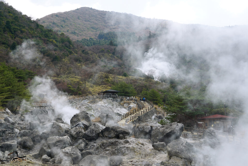
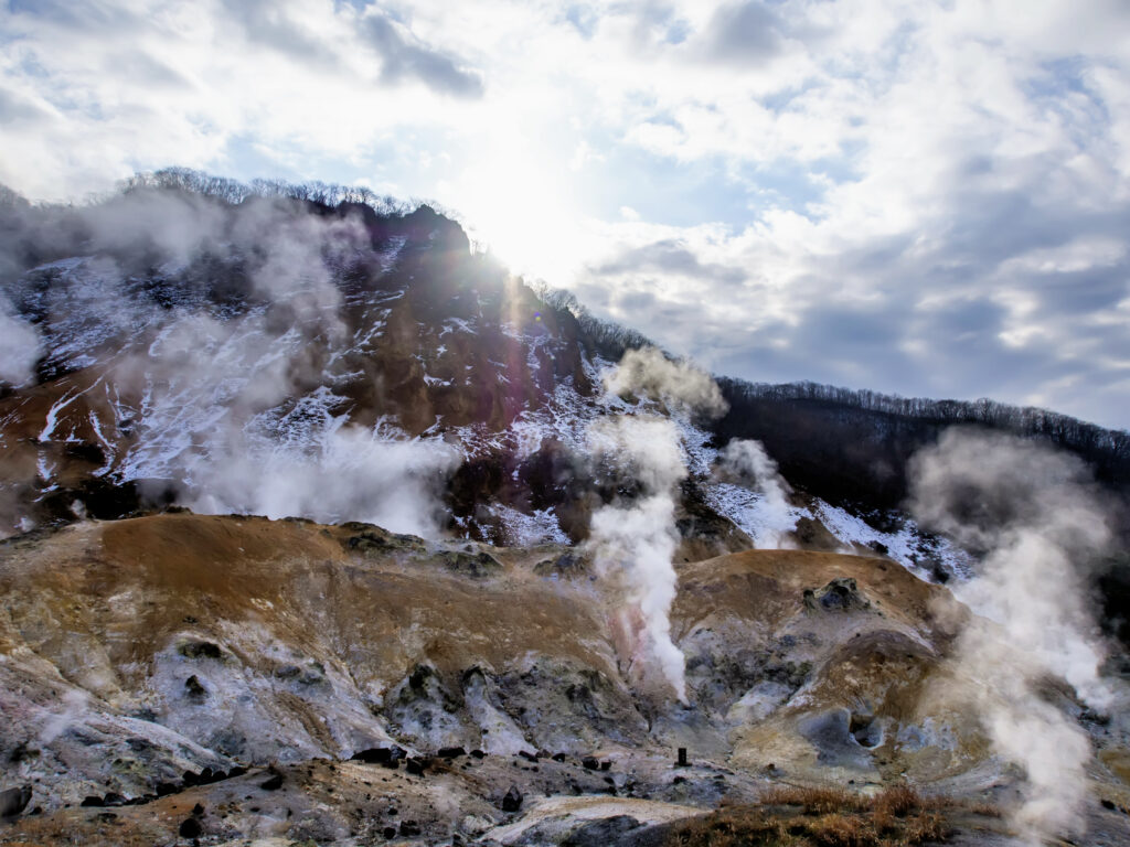
8. Kyushu Island, Japan
Kyushu, the southernmost of Japan’s main islands, is renowned for its volcanic activity and geothermal features. The island hosts several active volcanoes and numerous hot springs, or “onsen,” many of which are accompanied by impressive geysers. Two of the most notable geothermal areas on Kyushu are Beppu and Unzen.
At Beppu, Tatsumaki Jigoku (Tornado Hell) geyser erupts every 30 to 40 minutes, sending a column of hot water and steam up to 50 feet (15 meters) into the air. Unzen-Amakusa National Park is part of the Unzen volcanic complex. The Unzen volcanic complex includes several active and dormant volcanoes, with Mount Unzen being the most prominent. Unzen Jigoku (Unzen Hell) is a geothermal area featuring numerous steaming vents, boiling hot springs, and sulfurous fumaroles. The landscape is rugged and otherworldly, with wooden pathways allowing visitors to safely explore the area. The hot springs here are known for their high sulfur content, which is believed to have health benefits.
Kyushu Island is well-connected by transportation, making it relatively easy to access its geothermal attractions. Major cities like Fukuoka, Nagasaki, and Kumamoto have airports and are linked by the Kyushu Shinkansen (bullet train) and an extensive network of highways and local trains. The journey typically involves a combination of train and bus travel, but the scenic landscapes make the trip worthwhile.
7. Shikotsu-Toya National Park, Hokkaido, Japan
Shikotsu-Toya National Park, located on the island of Hokkaido in Japan, is renowned for its stunning volcanic landscapes, beautiful lakes, and abundant geothermal activity, including geysers and hot springs. The park is named after its two main lakes, Lake Shikotsu and Lake Toya, both of which are caldera lakes sitting above volcanic activity. In Shikotsu-Toya National Park is the active volcano Mount Usu, which overlooks Lake Toya. Mount Usu has erupted several times in recent history, with the most recent significant eruptions occurring in 2000.
One of the most famous geothermal sites in the park is the Noboribetsu Onsen area, often referred to as “Hell Valley” (Jigokudani). This valley is filled with steaming vents, bubbling mud pots, and geysers, creating a dramatic and otherworldly landscape. Visitors can walk along boardwalks and trails to safely observe these geothermal phenomena up close.
Accessibility to Shikotsu-Toya National Park is convenient, with well-developed transportation infrastructure. The park can be reached from the major city of Sapporo by bus or train, making it a popular destination for both domestic and international tourists. Within the park, there are several towns and resorts, such as Noboribetsu and Toyako Onsen, which provide accommodations and access to the geothermal features.
6. New Zealand’s North Island
New Zealand is renowned for its geothermal activity, particularly in the Rotorua and Taupo regions of the North Island. In the Rotorua region, Pohutu Geyser, located in Te Puia, is the largest active geyser in the Southern Hemisphere. It erupts up to 20 times a day, reaching heights of 100 feet (30 meters). Te Puia also offers a glimpse into Maori culture, with traditional performances and crafts on display. There is also Whakarewarewa. This living Maori village features several geysers, including the Prince of Wales Feathers and Kereru geysers. Visitors can explore the village, learn about Maori traditions, and enjoy guided tours that highlight both the cultural and geothermal aspects of the area.
In the Taupo Volcanic Zone is Orakei Korako, known as the “Hidden Valley.” It boasts numerous geysers, sinter terraces, and hot springs.
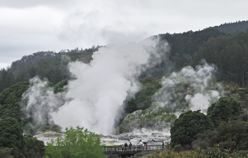
Both Rotorua and Taupo are easily accessible by road from major cities like Auckland and Wellington. Rotorua also has its own regional airport, with flights connecting to Auckland, Wellington, and Christchurch. The geothermal parks in these regions are well-developed for tourism, with visitor centers, guided tours, and amenities to enhance the experience.
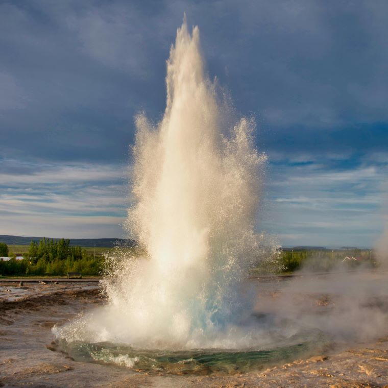
5. Haukadalur Valley, Iceland
Iceland sits in the center of the Atlantic ocean rift zone. The island is renowned for its geothermal activity, with geysers being one of the country’s most iconic natural features. The most famous geysers in Iceland are located in the Haukadalur Valley in the southwest of the country, part of the Golden Circle tourist route. This area includes the Great Geysir, which has given its name to geysers worldwide, and its active neighbor, Strokkur. Geysir was once highly active, with eruptions reaching heights of up to 170 meters (558 feet). However, its activity has diminished over the years, and it now erupts infrequently. Just a short distance from the Great Geysir, Strokkur is the most active and reliable geyser in the Haukadalur Valley. It erupts approximately every 5 to 10 minutes, sending a column of hot water and steam up to 20 meters (65 feet) into the air, sometimes reaching even higher.
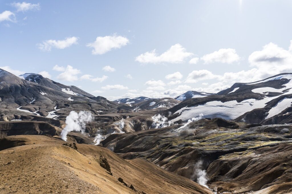
Haukadalur Valley is part of the Golden Circle, a popular tourist route that is easily accessible from Reykjavik, Iceland’s capital. The valley is approximately a 1.5 to 2-hour drive from Reykjavik, and many guided tours are available, making it convenient for tourists to visit.
4. Sol de Mañana, Eduardo Avaroa Andean Fauna National Reserve, Bolivia
Sol de Mañana which translates to “Morning Sun,” is a geothermal area in the larger Eduardo Avaroa Andean Fauna National Reserve of southwestern Bolivia. The area is known for intermittent geysers releasing heat from volcanoes of the Andes Mountains. Spouting boiling water and steam, activity is most intense in the morning, which is how the area got its name. Geysers and fumaroles create an otherworldly landscape with steam rising from the ground, bubbling mud pools, and vibrant mineral deposits. In addition to geysers, the area features boiling mud pots and hot springs. The high temperature and mineral-rich waters produce a variety of colors and textures, making Sol de Mañana a visually striking location.
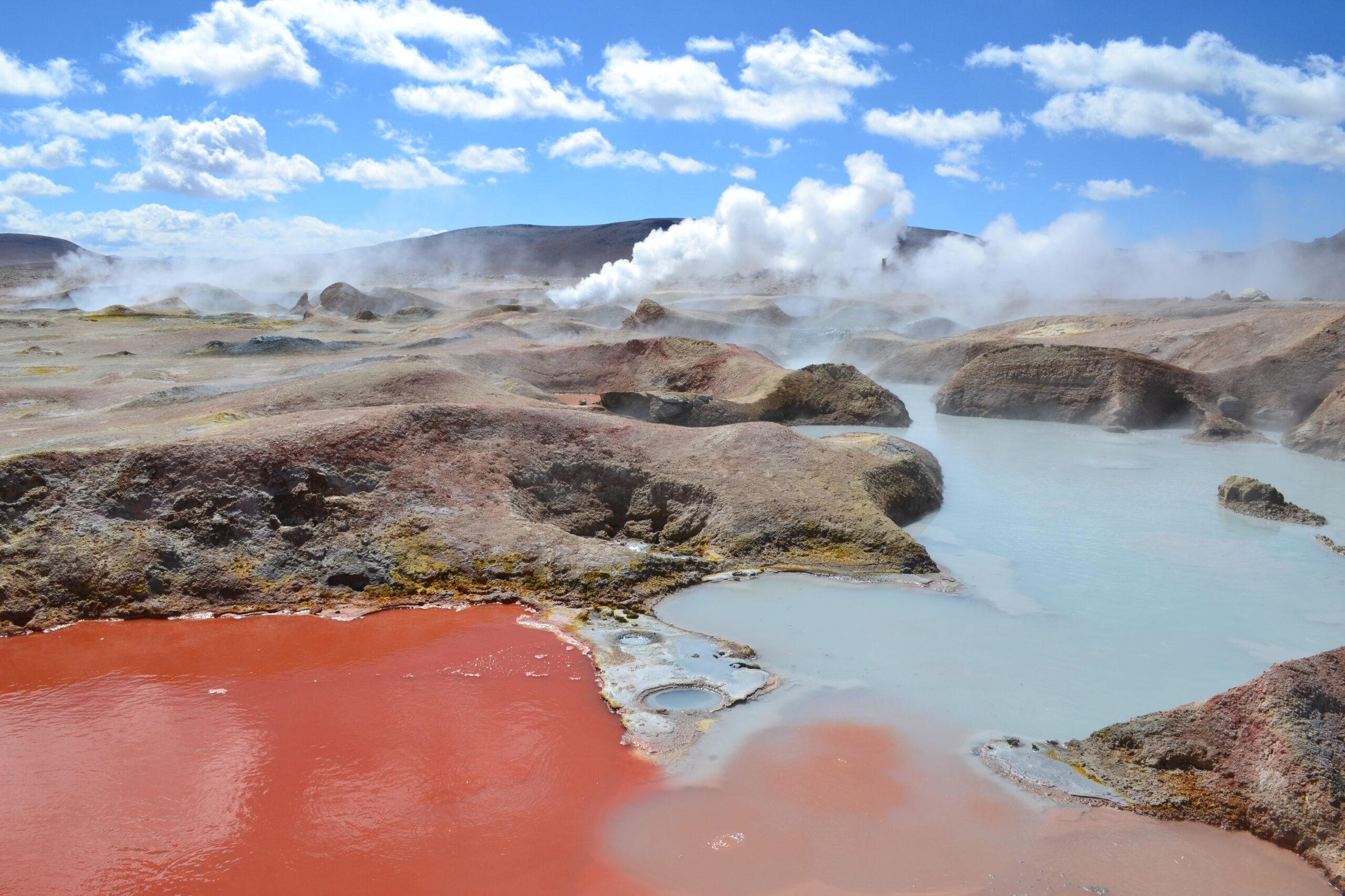
At nearly 5,000 meters above sea level, Sol de Mañana is one of the highest geothermal areas in the world. Visitors need to be prepared for the effects of high altitude, such as reduced oxygen levels and colder temperatures. Reaching Sol de Mañana is challenging due to its remote location and high altitude. The area is typically visited as part of multi-day tours of the Altiplano region, which often include other natural attractions such as the Uyuni Salt Flats, Laguna Colorada, and Laguna Verde. Most visitors join guided tours that depart from the town of Uyuni or the Chilean town of San Pedro de Atacama. These tours usually use 4×4 vehicles to navigate the rugged terrain and include stops at various points of interest in the Eduardo Avaroa Andean Fauna National Reserve.
3. El Tatio Geysers, Atacama Desert, Chile
The El Tatio Geysers, located in the Atacama Desert of northern Chile, is home to over 80 active geysers. Making it the largest geyser field in the southern hemisphere and the 3rd largest geyser field in the world. Geysers at El Tatio can erupt up to 10 meters (33 feet) high, creating impressive steam columns against the backdrop of the Andean mountains. The best time to experience El Tatio Geysers is early in the morning, when temperatures are coldest and the contrast between the hot steam and the chilly air is most dramatic. This timing also enhances the visibility of the steam columns against the clear desert sky.
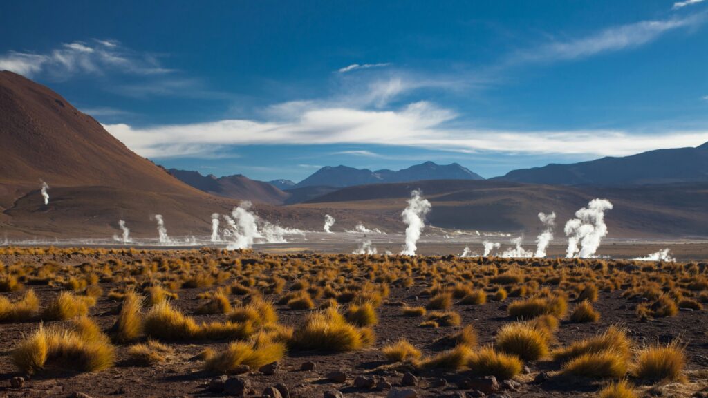
Being one of the highest-altitude geyser fields in the world at approximately 4,320 meters (14,170 feet) above sea level, access to El Tatio can be challenging. Most visitors opt for guided tours that provide transportation in 4×4 vehicles, ensuring safe navigation of the unpaved roads and offering insight into the region’s geological and cultural history. The nearby town of San Pedro de Atacama serves as a base for tours to the geysers, which typically depart early in the morning to witness the sunrise and the geyser activity.
2. Valley of Geysers, Kronotsky Nature Reserve, Russia
The Valley of Geysers (Долина гейзеров) in far east Russia is the second largest geyser field in the world, hosting approximately 90 geysers in total. Located within Kronotsky Nature Reserve it is tucked away on the remote but highly volcanic Kamchatka Peninsula. The Valley of Geysers is home to numerous geysers, hot springs, and fumaroles. Geysers here can erupt with steam and hot water shooting tens of meters into the air, creating a spectacular display against the backdrop of Kamchatka’s volcanic peaks. The valley itself is characterized by lush greenery, steep cliffs, and a winding river that runs through the geothermal field. The contrast between the vibrant vegetation and the steam vents and hot springs adds to the valley’s unique appeal.
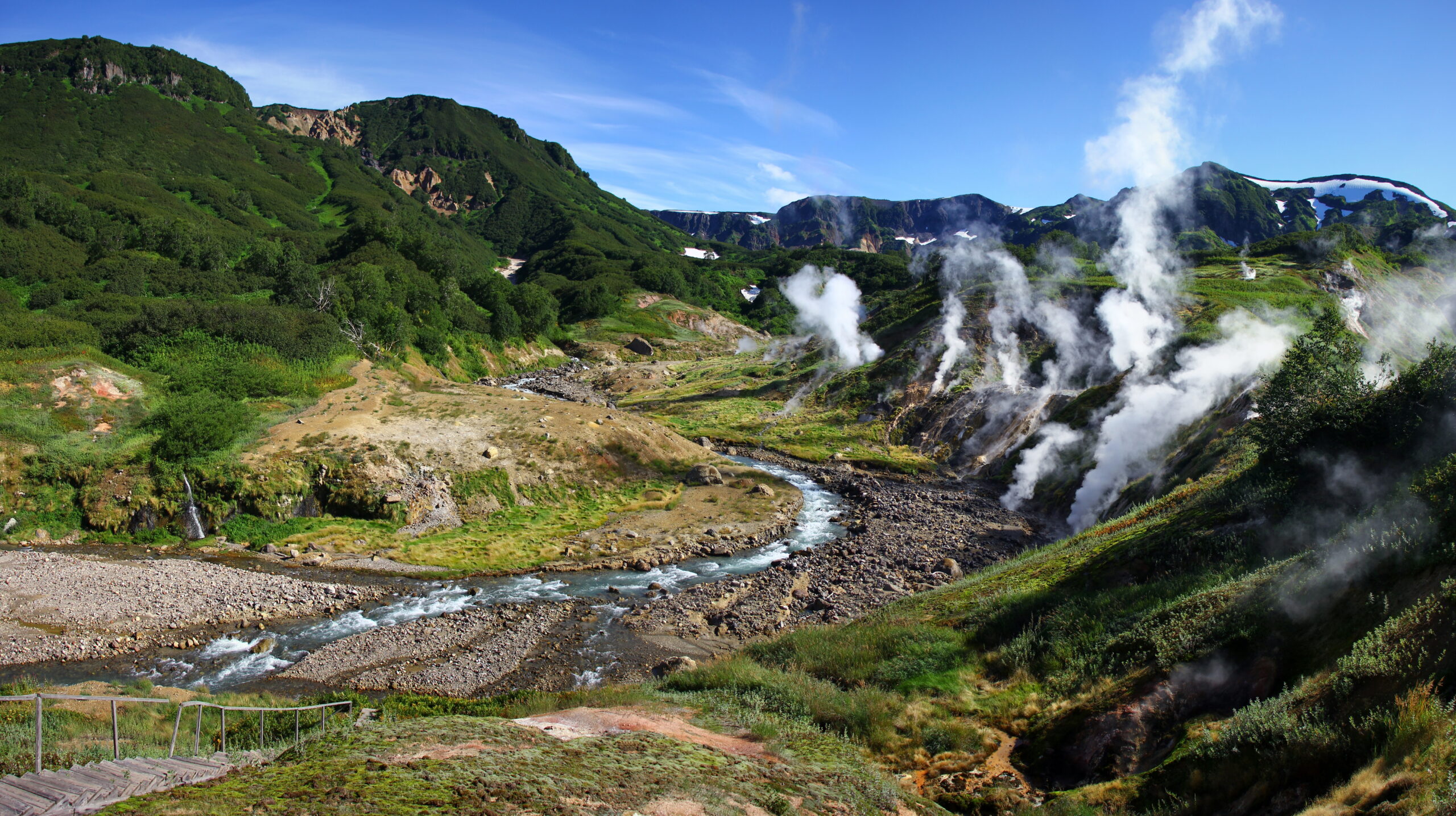
Due to its remote location, visiting the Valley of Geysers typically requires organized tours or expeditions led by experienced guides. Tours often depart from the regional capital, Petropavlovsk-Kamchatsky, and may include other highlights of Kamchatka’s natural beauty. Kamchatka is remote and isolated, accessible primarily by helicopter or via a multi-day trek through rugged terrain.
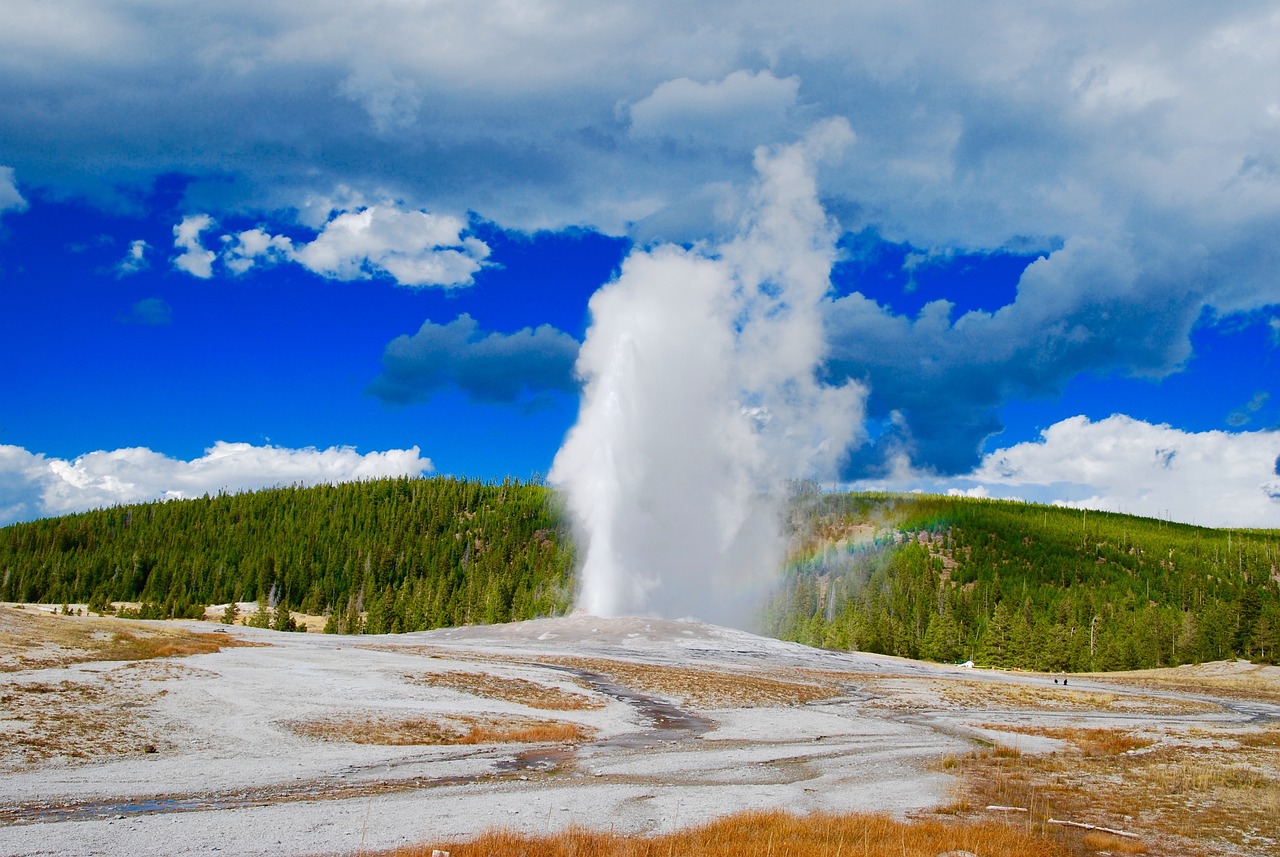
1. Yellowstone National Park, USA
Yellowstone National Park the most well known geyser destination for good reason. With more than 500 geysers, it is the largest geyser field in the world 5 times over. It’s geysers are large, frequently erupt and full of unique character. Yellowstone sits atop a volcanic hotspot, resulting in intense geothermal activity. The geysers, hot springs, and other features are fueled by heat from a magma chamber located relatively close to the Earth’s surface. The major geyser basins in Yellowstone are located in the central and western parts of the park. The most famous geyser basins include Upper Geyser Basin (home to Old Faithful), Norris Geyser Basin, Lower Geyser Basin, and West Thumb Geyser Basin.
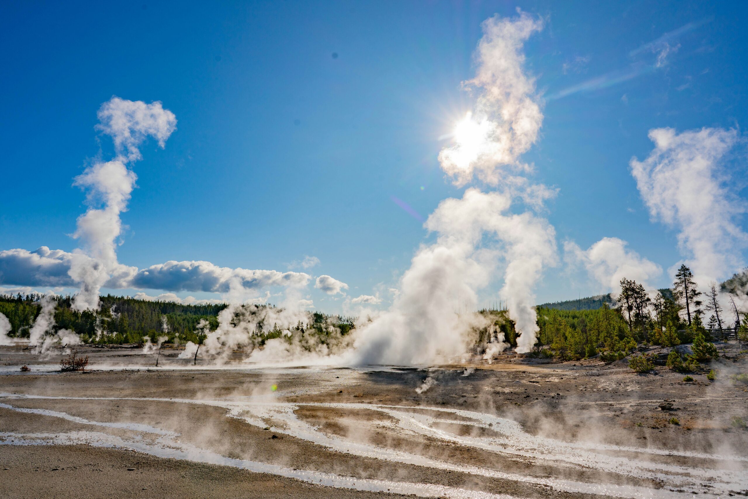
Yellowstone National Park was established in 1872, it is the world’s first national park and spans across Wyoming, Montana, and Idaho. The park is accessible via several entrances, with the most popular being near towns like West Yellowstone (Montana), Gardiner (Montana), and Jackson (Wyoming). Yellowstone’s geyser basins are interconnected by boardwalks and trails that allow visitors to explore the geothermal features safely. Educational signs provide information about the geological processes and the unique ecosystems supported by the geothermal waters. Each geyser basin has a visitor center or ranger station where visitors can learn about the geology, ecology, and history of the area through exhibits, ranger talks, and guided walks.
If you want to know how geysers are made check out the Geo Recipe!